


Best Hikes in Big Sur: What’s Open Now
I live and work on the Monterey Peninsula, and Big Sur is where I go when I want a real day outside. After this summer’s Timber and Plaskett fires, the big question is what’s actually open. Here are my two favorites, the trails you can hike right now, and what’s still closed.
Trail status, As of October 18, 2026
- Highway 1: open through Big Sur, with one-way traffic control at Rocky Creek Bridge (24/7 through Nov. 30), Mud Creek (weekday mornings through Nov. 13) and near Point Sur (Caltrans).
- Pfeiffer Big Sur: reopened Oct. 16. Pfeiffer Falls, Valley View, Oak Grove, Mt. Manuel, the River Gorge and Pine Ridge stay closed (State Parks).
- Julia Pfeiffer Burns: day use and Partington Cove open. The McWay Falls Overlook Trail and all trails east of Highway 1 are closed (State Parks).
- Andrew Molera: trails west of the highway open. East Molera and all trails east of Highway 1 are closed (State Parks).
- Los Padres National Forest: a Forest Service fire closure covers the Timber and Plaskett fire area through Jan. 31, 2027 (Forest Service).
Things change fast here. Check Caltrans QuickMap and the park pages the morning you go.
My two favorites
Two very different days: one that will test your legs, and one that works for everyone from grandparents to toddlers.
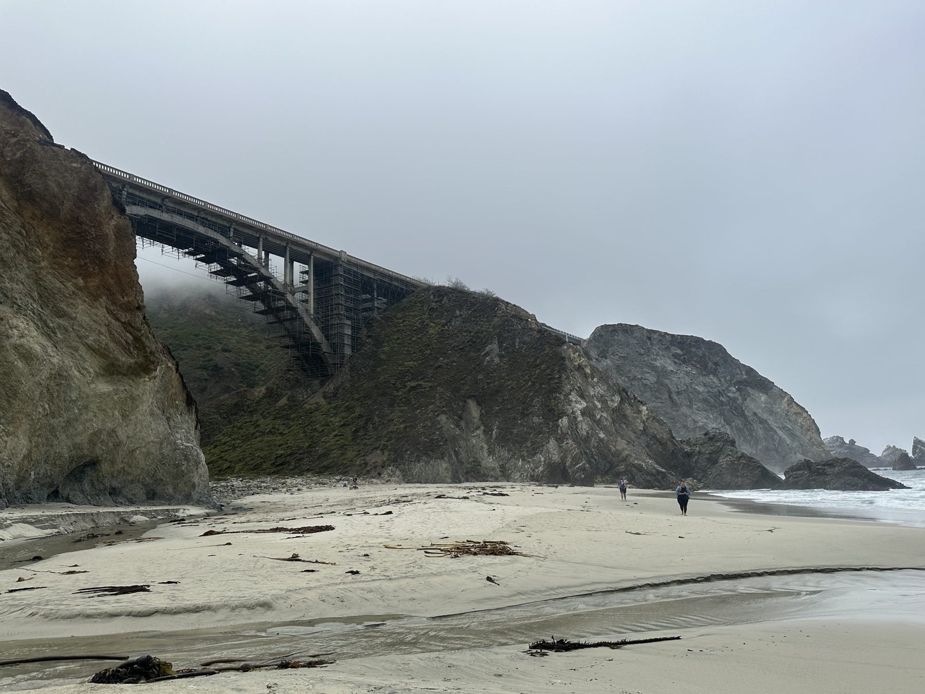
Boronda Trail
- Hard to very difficult
- Constant steep climb
- Unsigned trailhead on Highway 1
- Check before you go: fire closure
“It’s a constant steep climb, and it feels unrelenting at times, but the views are incredible once you get up there. If you’re into pushing yourself, cardio and building endurance, this is the hike for you. Just come prepared.”
- WhereAn old ranch road that climbs from Highway 1, south of the Coast Gallery near Torre Canyon, up to Timber Top on the Coast Ridge. The trailhead isn’t signed, so look it up before you go.
- DifficultyHard to very difficult. Bring more water than you think you need and start early.
- StatusAs of October 18, 2026 The Forest Service’s fire closure order covers the Timber and Plaskett fire area through January 31, 2027, and the Ventana Wilderness Alliance reports that virtually all of the Monterey Ranger District is closed. Call the Forest Service’s Big Sur Visitor Center (831-667-2315) before you go (Forest Service order).
Redwoods along the Big Sur River
- Open
- River Path: 0.6-mi loop
- Wheelchair & stroller accessible
- Dogs on the River Path
- $10 day use
“It’s not quite a hike. Park at Big Sur Lodge and walk through the redwoods along the river. It’s great when you bring a wide age range of family and friends.”
- WherePfeiffer Big Sur State Park, 26 miles south of Carmel on Highway 1. Big Sur Lodge is inside the park.
- The walkThe River Path and Warden’s Path make a 0.6-mile loop along the river, past the Redwood Deck and picnic areas. The Redwood Grove Boardwalk is open too (State Parks).
- StatusAs of October 18, 2026 Open since the park reopened on October 16 (State Parks).
Open and easy
Distances are from the State Parks trail pages.
Partington Cove Trail
- Open
- 1 mi round trip
- No dogs
An old wagon road from a green gate on Highway 1 down to the ocean. At the bottom, the south fork goes through a historic tunnel to an overlook that was once a loading dock for ships. The walk back up is steep. Stay behind the overlook bench; the surf is unpredictable (State Parks).
Creamery Meadow Trail
- Open
- 2 mi round trip
- River crossing
An easy walk to the beach at the mouth of the Big Sur River. State Parks puts in a seasonal footbridge around June 15 and removes it around October 31, so later in the year you’ll have to wade across. Use extreme caution (State Parks).
Nature Trail
- Open
- 0.7 mi round trip
A short, self-guided trail about Big Sur’s native plants, across from Day Use Lot 2 (State Parks).
Bluffs Trail
- Open
- 1.7 mi one way
- Hikers only
An easy trail along the bluffs above the beach. You can’t get down to the sand until the Spring Trail junction at 1.7 miles (State Parks).
Harder, and open now
Buzzards Roost
- Open
- 3-mi loop
- About 750 ft of climbing
State Parks calls it moderate to strenuous. The loop follows the river, climbs through redwoods and ends on an exposed ridge with views of the ocean, Sycamore Canyon and the Santa Lucia Mountains. It starts across the river from the Redwood Deck (State Parks).
Ridge and Panorama trails
- Open
- Ridge: 3.2 mi one way
- Panorama: 1.3 mi one way
Both are listed as strenuous. The Ridge Trail is exposed, with big views; the Panorama Trail is steep and passes a pygmy redwood forest. Hikers often link them with the Bluffs Trail. Remember the river crossing once the footbridge comes out (State Parks).
Soberanes Canyon
- Open
- 1.25 mi to the back of the canyon
- No dogs
Out and back only, from the gated trailhead across from Gate 8 on Highway 1; the Rocky Ridge Trail is closed. It’s the closest of these to Carmel-by-the-Sea. Park carefully, since the shoulders get busy (State Parks).
Closed for now, and what to do instead
Pfeiffer Falls & Valley View
- Closed
Closed until further notice for recovery work in burned areas (State Parks). Instead: walk the Redwood Grove Boardwalk and River Path, or climb Buzzards Roost.
McWay Falls Overlook Trail
- Closed
State Parks lists it closed for a retaining wall project, and the beach and falls are always off-limits (State Parks). Instead: Partington Cove, in the same park.
Ewoldsen Trail
- Closed indefinitely
All backcountry trails east of Highway 1 in Julia Pfeiffer Burns and Andrew Molera are closed indefinitely (State Parks). Instead: Molera’s trails west of the highway.
Mt. Manuel & Pine Ridge (Sykes)
- Closed
Both are closed in the state park and named in the Forest Service closure order (Forest Service). Instead: Buzzards Roost for a climb with a view.
Planning: roads, fees and dogs
| Place | Dogs allowed? |
|---|---|
| Pfeiffer Big Sur | Only on the River Path and Warden’s Path, lots and campground |
| Andrew Molera | No |
| Julia Pfeiffer Burns | No |
| Garrapata | On leash at the Gate 19 beach only |
| Point Lobos | No, anywhere |
Check the roadHighway 1 has several one-way traffic controls this fall. Check Caltrans QuickMap before you leave and allow extra time.
Bring $10 a carState Parks lists a $10 vehicle day-use fee at Pfeiffer Big Sur, Andrew Molera, Julia Pfeiffer Burns and Point Lobos.
Respect the closuresBurned areas can have unstable trees, falling rocks and debris flows in rain. State Parks cites violators who enter closed areas.
Closer to home? See my best hikes in Monterey & Carmel-by-the-Sea for Point Lobos, Garrapata and Carmel Valley trails.
Frequently asked questions
Is Pfeiffer Falls open?
No. Pfeiffer Big Sur State Park reopened on October 16, 2026, but State Parks is keeping the Pfeiffer Falls and Valley View trails closed until further notice while burned areas recover. The Redwood Grove Boardwalk and River Path near Big Sur Lodge are open.
Is McWay Falls open?
The Waterfall Overlook Trail at Julia Pfeiffer Burns State Park is closed for a retaining wall project, according to State Parks. The beach and the falls themselves are always off-limits. The park’s day-use area and the Partington Cove Trail are open.
Is Highway 1 open through Big Sur?
Yes, as of October 18, 2026, but Caltrans has one-way traffic control in several spots, including Rocky Creek Bridge around the clock through November 30 and Mud Creek on weekday mornings through November 13. Check Caltrans QuickMap before you drive.
What Big Sur hikes are open right now?
As of October 18, 2026: Buzzards Roost, the River Path and the Redwood Grove Boardwalk at Pfeiffer Big Sur; the Bluffs, Panorama, Ridge and Creamery Meadow trails west of the highway at Andrew Molera; Partington Cove at Julia Pfeiffer Burns; and Soberanes Canyon at Garrapata. Backcountry trails east of Highway 1 in Andrew Molera and Julia Pfeiffer Burns are closed indefinitely.
What’s the best easy hike in Big Sur?
For a mixed group, I park at Big Sur Lodge and walk through the redwoods along the river. State Parks lists the River Path and Warden’s Path as a 0.6-mile loop that is wheelchair and stroller accessible. Partington Cove is another short one, at 1 mile round trip, but the walk back up is steep.
Are dogs allowed on Big Sur trails?
Mostly no. At Pfeiffer Big Sur, dogs are allowed only on the Warden’s Path and River Path and in the day-use lots and campground. Andrew Molera and Julia Pfeiffer Burns list no dogs, Point Lobos allows none anywhere, and Garrapata allows leashed dogs only at the Gate 19 beach and the trails to it.
How far is Big Sur from Carmel-by-the-Sea?
State Parks puts Andrew Molera 20 miles south of Carmel, Pfeiffer Big Sur 26 miles south, and Julia Pfeiffer Burns 37 miles south on Highway 1.
Living near Big Sur
Thinking about a home on this coast? See my Big Sur homes and area guide.
