


Best Hikes in Monterey & Carmel-by-the-Sea: A Local’s List
I live and work in Carmel-by-the-Sea, and some of my favorite days here are spent on a trail. Below are the three hikes I keep going back to, in my own words, followed by the other walks and hikes I’d point a friend to, from easy coastal strolls to real climbs.
Trail status, permits and dog rules checked against official park sites on October 17, 2026. Conditions change, so tap the source links before you go.
Quick picks
- Best bay viewJacks Peak, on a clear day
- Best real climbPalo Corona to Inspiration Point
- Best for a long day in the hillsGarland Ranch
- Easiest ocean walkthe Rec Trail in Pacific Grove
- Best short coastal trailsPoint Lobos (no dogs)
- Best with a dog in townCarmel Beach or Mission Trail
My three favorites
These are the ones I recommend first. The quotes are mine; the details under each come from the agency that runs the park.
Jacks Peak County Park
- About 8.5 mi of trails
- 0.8-mi Skyline loop
- Dogs on leash (7 ft max)
- Small day-use fee
“Jacks Peak is always an incredible spot, mostly for the view of Monterey Bay. Try to go on a clear day.”
- What it isa day-use county park off Highway 68 with about 8.5 miles of trails through one of the last natural Monterey pine forests (Monterey County Parks).
- The short onethe Skyline Self-Guided Nature Trail crosses the summit and has Miocene-era fossils along the way (Monterey County Parks). See Monterey lists it as a 0.8-mile loop (See Monterey).
- Dogsallowed on a leash no longer than 7 feet (county pet policy). No bikes on the trails.
- Before you gothere is a small day-use entry fee, and hours change by month, so check the county page. The park closes in high winds and storms.
Garland Ranch Regional Park
- No permit for the main park
- About 200 ft to near 2,000 ft
- Dogs welcome
- Dawn to dusk
“Garland Ranch is a wonderful place to hike. My insider tip: most people come in from the main parking lot off Carmel Valley Road, so look for the trailheads off East Garzas Road instead, or at the top of Via Las Encinas off West Garzas Road. And if you find yourself in Carmel Valley Village, there’s also trailhead access off Calle de los Helechos.”
- Main entrance700 West Carmel Valley Road, with upper and lower lots and a small visitor center. No access permit is needed for the main park (MPRPD).
- East Garzas trailheadfrom Carmel Valley Road, turn onto Boronda Road, then left on East Garzas Road; the trailhead is on the right (MPRPD directions). It’s a neighborhood trailhead with roadside parking, so park considerately.
- Terraintrails climb from the Carmel River, at about 200 feet, to ridges near 2,000 feet (MPRPD).
- Dogswelcome on leash or under immediate voice and visual control; pick up after them (park rules). Open dawn to dusk.
- Heads-upthe Kahn Ranch section, entered from Hitchcock Canyon Road, needs an access permit (MPRPD).
Palo Corona Regional Park
- Inspiration Point: 2.2 mi, 750-ft climb
- Moderate to strenuous
- Permit depends on entrance
- No dogs in the main ranch
“Palo Corona is a fun spot. It can be a shorter hike, but the climb up to Inspiration Point gives you incredible views, and you get to walk through open space shared with cows.”
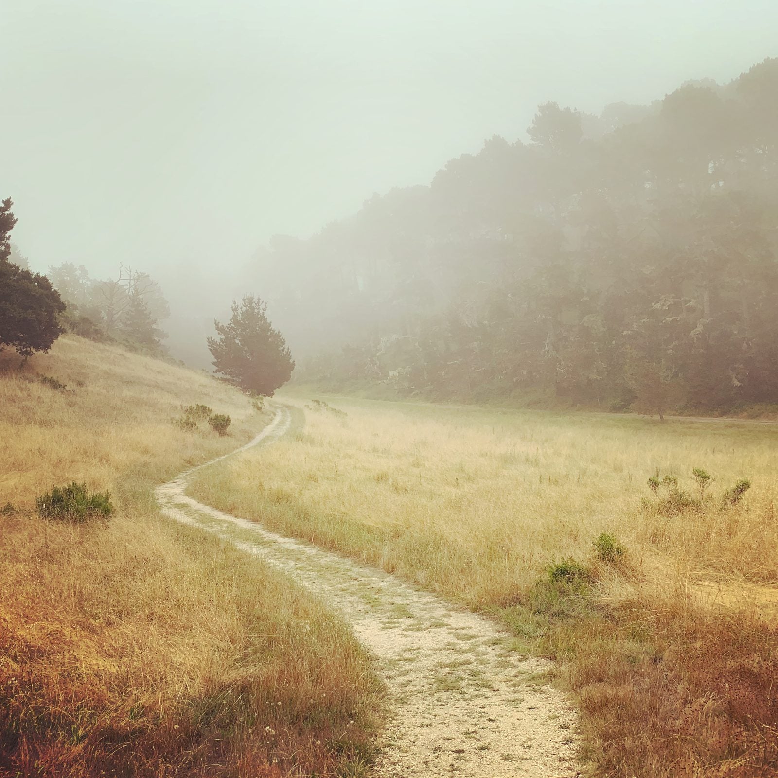
- Inspiration PointMPRPD lists the route as 2.2 miles with a 750-foot climb, moderate to strenuous, ending at a picnic bench with a bird’s-eye view of the coast (MPRPD).
- Permitsnone needed if you enter through the Rancho Cañada unit (Village Park Road off Carmel Valley Road) or walk or bike to the South Bank Trail entrance. An access permit is required to enter at the Highway 1 gate or to park at the South Bank lot (MPRPD rules).
- Construction note (as of October 17, 2026)the Rancho Cañada floodplain restoration runs 2025–2027. The 0.6-mile Detour Trail is the main route from the parking lot to the South Bank Trail and Inspiration Point; follow posted signs (project site).
- The cows are realthe park uses conservation cattle grazing to manage its grasslands, under a lease now extended through September 2027 (MPRPD board report). Give them room.
- Dogsnot allowed in the main ranch section because of grazing and sensitive species. Leashed dogs are allowed on the Rancho Cañada unit (permit conditions). Hiking only: no bikes or horses.
Easy coastal walks
Mostly flat, mostly by the water, and easy to fit into a morning.
Monterey Bay Coastal Recreation Trail
- 18 mi, paved
- Aquarium to Lovers Point: about 1 mi
An 18-mile paved path from Pacific Grove to Castroville, mostly on the old Southern Pacific rail line, passing Cannery Row, the Aquarium and Fisherman’s Wharf (City of Monterey). For a classic walk, take the Pacific Grove stretch from the Aquarium to Lovers Point, about a mile, where walkers and cyclists have separate paths (City of Pacific Grove). There is no camping on the trail.
Asilomar Coast Trail
- About ¾ mi
- Dogs on leash
About three-quarters of a mile of trail and boardwalk along Asilomar’s rocky shore and pocket beaches, with entry points all along Sunset Drive. Dogs are welcome on leash. Some sections are eroding, so stay on the trail and boardwalk (State Parks).
Carmel Beach and the Scenic Road path
- Dogs off leash under voice control
Walk the sand at the foot of Ocean Avenue, then follow Scenic Road south toward Carmel River State Beach for views of Point Lobos. Carmel-by-the-Sea allows dogs off leash on Carmel Beach if they’re under voice control (City of Carmel-by-the-Sea).
Carmel River State Beach and lagoon
- Mile-long beach
- Dogs on leash
- 8 a.m. to sunset
A mile-long beach with a bird sanctuary in the lagoon where the Carmel River meets the sea. Leashed dogs are allowed; open 8 a.m. to sunset. Don’t swim or wade near the sanctuary; it can be extremely dangerous. As of October 17, 2026: beach access off Scenic Road at Ocean View and Valley View is temporarily closed, with Valley View under construction into early November. Use the main lot (State Parks).
Mission Trail Nature Preserve
- Dogs under voice control
- No bikes
- No restrooms
The city’s largest open space, with the Flanders, Doolittle, Willow, Mesa and Serra trails through pines, oaks and willow wetlands. Enter from Rio Road, Hatton Road or Mountain View Avenue. Dogs are allowed under voice control; no bikes and no restrooms (City of Carmel-by-the-Sea).
Short hikes with big views
Point Lobos State Natural Reserve
- 0.8-mi loops
- No dogs
- 8 a.m. to 7 p.m.
Short trails with huge payoffs. The Cypress Grove Trail is a 0.8-mile loop through one of only two natural Monterey cypress groves; the Bird Island Trail is 0.8 mile round trip; Whalers Knoll climbs about 180 feet (Point Lobos Foundation). No dogs anywhere in the reserve, not even left in the car. Hours are 8 a.m. to 7 p.m., with last entry at 6:30 p.m.; vehicles over 21 feet aren’t allowed. As of October 18, 2026: State Parks lists no current restrictions for the reserve; check its page before you go (State Parks).
Huckleberry Hill Nature Preserve
- 81 acres
- Bay and coast views
An 81-acre city preserve of Monterey pine forest with bay and coastline views, reached on foot through Veterans Memorial Park (City of Monterey). Don’t confuse it with the Huckleberry Hill area inside Pebble Beach’s Del Monte Forest, where Pebble Beach maintains more than 27 miles of trails; its Green Trail Loop runs 10.7 miles and climbs about 650 feet up Huckleberry Hill (Pebble Beach).
Garrapata State Park: Soberanes Canyon
- 1.25-mi out-and-back
- No dogs on the trail side
A canyon walk from coastal scrub into redwoods. As of October 17, 2026: Soberanes Canyon Trail is open as a 1.25-mile out-and-back from the gated trailhead across from Gate 8; the Rocky Ridge Trail is closed. No dogs on this side of Highway 1 (leashed dogs are allowed only at the Gate 19 beach). Park carefully on the highway shoulder (State Parks).
Heading to Big Sur?
Some Big Sur trails are open again after the Timber Fire, and some are still closed.
See my Big Sur hiking guide for what’s open now, my favorite hikes and Highway 1 updates.
Dogs, parking and planning
Dog rules vary a lot from park to park here. This table sums up each agency’s rule as of October 17, 2026; the sources are linked in each section above.
| Place | Dogs allowed? |
|---|---|
| Jacks Peak County Park | Yes, leash 7 ft max |
| Garland Ranch | Yes, leash or voice and visual control |
| Palo Corona (main ranch) | No |
| Palo Corona (Rancho Cañada unit) | Yes, on leash |
| Mission Trail Nature Preserve | Yes, under voice control |
| Carmel Beach | Yes, off leash under voice control |
| Carmel River State Beach | Yes, on leash |
| Asilomar Coast Trail | Yes, on leash |
| Point Lobos | No, anywhere |
| Garrapata: Soberanes Canyon | No (leashed at the Gate 19 beach only) |
Chase the clear days. Fog is common on this coast from July through September (State Parks). When the coast is gray, Carmel Valley trails like Garland Ranch can be the better bet.
Park carefully on Highway 1. State Parks asks for extreme caution when parking and crossing the highway at Garrapata, and Point Lobos doesn’t allow vehicles over 21 feet.
Stay on the trail. Most of these parks require it, and it’s the best way to avoid poison oak and ticks.
Out with a dog afterward? Here’s my list of dog-friendly restaurants. Ending the day on the coast? See where to watch the sunset.
Frequently asked questions
What is the best hike in Monterey?
For the view of Monterey Bay, my pick is Jacks Peak County Park on a clear day. For a coastal walk, the Monterey Bay Coastal Recreation Trail from the Aquarium to Lovers Point is hard to beat, and for a real climb, Inspiration Point at Palo Corona Regional Park.
What are easy walks in Monterey with ocean views?
The Monterey Bay Coastal Recreation Trail through Cannery Row and Pacific Grove, the Asilomar Coast Trail, Carmel Beach and the Scenic Road path, and the short trails at Point Lobos, like Bird Island and Cypress Grove.
How long is the Monterey Bay Coastal Recreation Trail?
The City of Monterey lists it at 18 miles, from Castroville in the north to Pacific Grove in the south. It’s paved, so you can walk any section.
Are dogs allowed at Point Lobos?
No. State Parks doesn’t allow dogs anywhere in Point Lobos State Natural Reserve, and they can’t be left in parked cars. Nearby, leashed dogs are allowed at Carmel River State Beach.
Are dogs allowed at Garland Ranch?
Yes. The park district allows dogs on leash or under immediate voice and visual control, and you must pick up after them.
Do I need a permit to hike Palo Corona?
Not if you enter through the Rancho Cañada unit off Carmel Valley Road, or walk or bike to the South Bank Trail entrance. You need an access permit to enter at the Highway 1 gate or to park at the South Bank lot. Dogs aren’t allowed in the main ranch section.
Where can I hike near Carmel-by-the-Sea?
Mission Trail Nature Preserve is inside the city. Palo Corona Regional Park and Carmel River State Beach are just south, Point Lobos is a short drive down Highway 1, and Garland Ranch is in Carmel Valley.
When is the best time to hike on the Monterey Peninsula?
Go on a clear day if you want the views. State Parks notes that fog is common along this coast from July through September, so inland hikes like Garland Ranch can be sunnier when the coast is gray.
Living near the trails
Trail access is a real part of why people choose a neighborhood here. Homes in Jacks Peak sit right by the county park. In Carmel Valley, Garland Ranch and Carmel Valley Village back up to Garland’s trailheads. Hatton Fields is next to Mission Trail Nature Preserve, and Carmel Highlands is the gateway to Point Lobos and Garrapata. For the coast, see Pacific Grove, Monterey, Pebble Beach and Carmel-by-the-Sea. More local reads are on my blog, including unusual things to do in Carmel-by-the-Sea and The Bench in Pebble Beach.
